SylvaTwin, RUMA's digital twin for cable cars, chairlifts and gondolas: one drone LiDAR flight finds the trees that could hit the line. A pilot with Trentino Sviluppo.
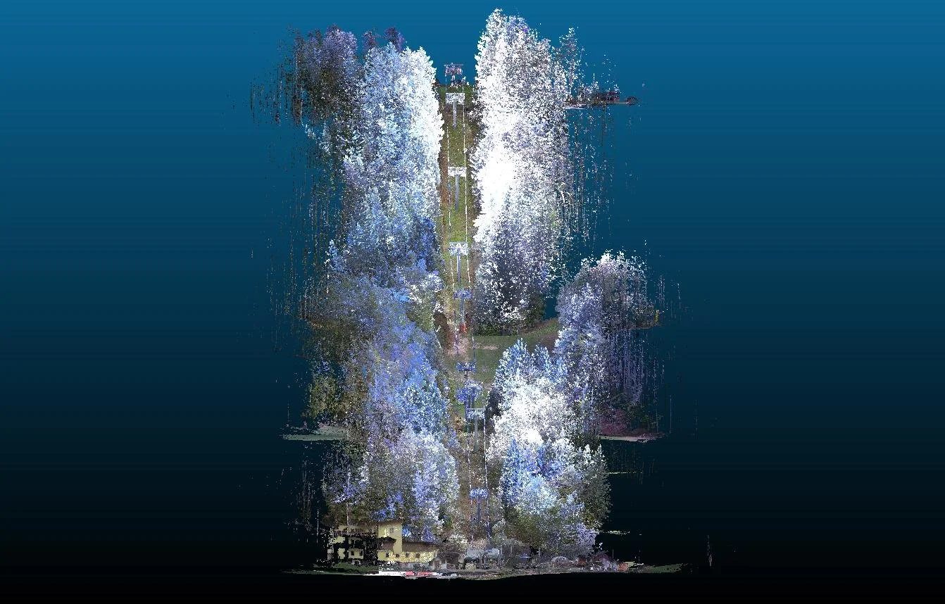
A few months ago we told you how the idea of RUMA's forest Digital Twin was born: the need to analyse a forest without having to be there in person every time, with the accuracy that forest management requires. Since then we have kept developing the tool and testing it in the field, in increasingly concrete settings.
Today we describe one of these applications: monitoring vegetation along ropeways.
The problem
A tree falls on a cable. A cabin stops halfway. Seven people injured in South Tyrol, a chairlift closed in New York, a gondola stopped at Carezza. These incidents, real and documented between 2023 and 2025, share one cause: the vegetation growing around the lines had not been monitored systematically.
Today, inspections are still carried out the traditional way: on foot, visually, on request. When the slope is steep, the vegetation dense or the weather poor, surveys become difficult and sometimes impossible.
SylvaTwin: seeing what the eye cannot reach
Our answer is SylvaTwin, a digital twin designed specifically for linear infrastructure: cable cars, chairlifts and gondolas.
The principle is simple. A drone carrying a LiDAR sensor flies over the whole line and captures a three-dimensional point cloud with centimetre-level accuracy. A single flight maps the entire line, including steep slopes and areas a technician could not safely reach on foot.
The result is not a photograph. It is a navigable digital model in which every tree is detected, measured and classified by height, distance from the cable and potential interference. Trees above the risk threshold are flagged by an algorithm, georeferenced and listed in a ready-to-use report.
Survey time is cut by 50% compared with traditional methods. The mean error in distance estimates is in the order of one centimetre.
Case study: a survey for Trentino Sviluppo
In May 2026 we applied this method to a ropeway managed by Trentino Sviluppo, as part of a pilot project in Trentino.
The work had four phases.
First, we placed ground control points, GPS-georeferenced markers, along the whole line. This anchors the drone point cloud to real-world coordinates and makes the data comparable over months and years.
Next, the drone flew the LiDAR survey, capturing millions of points along the cable corridor. Processing produced a point cloud that was normalised and coloured by height class.
In the third phase we extracted the trees at risk of interference: those whose height and position could make them dangerous if they fall or sway under snow load or wind. To find them we used an algorithm that accounts for tree height, distance from the cable (including a buffer for cable sway) and slope.
The final phase delivered a complete 3D view of the line: a navigable model that the operator can consult, share with safety engineers and archive as official documentation.
Why it matters, beyond safety
A stoppage on a single ropeway can cost tens of thousands of euros a day in lost revenue. On top of that come mandatory technical inspections, possible legal assessments, structural repairs and, above all, reputational damage: visitors avoid destinations associated with accidents.
Vegetation monitoring is therefore more than a regulatory duty. It is a long-term investment in the future of the line.
Next steps
We are extending the project to other ropeways in Trentino and across the Alps. If you would like to know more, get in touch: we are happy to answer questions or discuss future applications.
- Digital Twin
- LiDAR
- Ropeways
- Vegetation management
- Trentino